Nasa satellite images show how the climate crisis is transforming the planet
Before-and-after pictures show impact of floods, fires and melting ice

Sign up to the Independent Climate email for the latest advice on saving the planet
Get our free Climate email
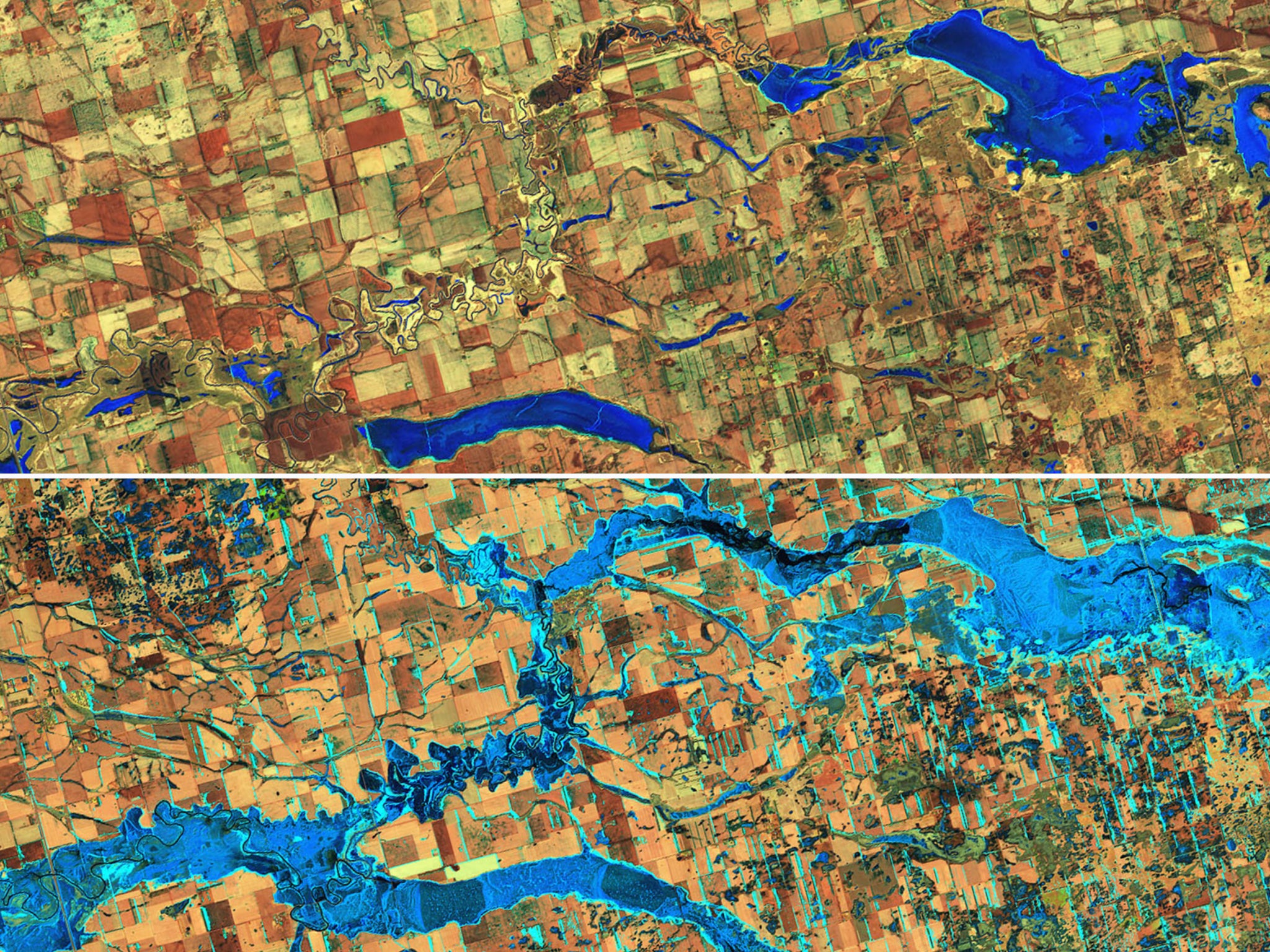
Nasa has released a series of satellite pictures which capture the impact of extreme weather events around the world in 2020.
The new pictures, part of a wider project called ‘Images of Change’, were released by Nasa's Global Climate Change group and are mostly composed of before-and-after shots which demonstrate the damage left in the wake of climate related events such as severe floods and wildfires.
Also included are pictures showing more prolonged measures of climate change, such as receding glaciers and desertification.
One pair of pictures shows the Mekong River, an important lifeline to nearly 60 million people across southeast Asia, changing colour.
While the water normally appears brown due to floating sediments, a section of the river in Thailand turned a bright blue in 2020.
Scientists said the change was due to shallow, slower moving waters not carrying as much sediment after a lengthy drought.
Nasa also captured pictures of Antarctica's second largest ice shelf showing record amounts of meltwater.
Scientists were concerned by the level of water, which was the highest in nearly 50 years of observation.
Particularly striking are pictures of flooding, such as in last year’s monsoon season in Bangladesh, where large areas of land are shown dry (before) then submerged (after).
Nasa said the 2020 monsoon season was unusually severe and a report from the UN Office for the Coordination of Humanitarian Affairs found more than 500 people were killed and more than 167,000 families were displaced across Bangladesh.
Not all of the pictures show climate change disasters. There is one pair showing India's Lonar Lake changing colour from green to pink, an as yet unexplained phenomenon.
There are also plenty of pictures of volcanic eruptions. On the Philippine island of Luzon, the Taal volcano erupted on 12 January 2020 depositing wet, heavy ash over the lush green landscape.
As the ash dried, it hardened from a mud-like consistency to that of cement, damaging most of the island's crops and other vegetation.
Hundreds more before and after pictures from Nasa’s Images of Change project can be viewed on the agencies climate change website.
Subscribe to Independent Premium to bookmark this article
Want to bookmark your favourite articles and stories to read or reference later? Start your Independent Premium subscription today.
Join our commenting forum
Join thought-provoking conversations, follow other Independent readers and see their replies