NASA satellite image shows grim Australian fire devastation from space
Nearly 100 fires have torched an area bigger than Connecticut in New South Wales.


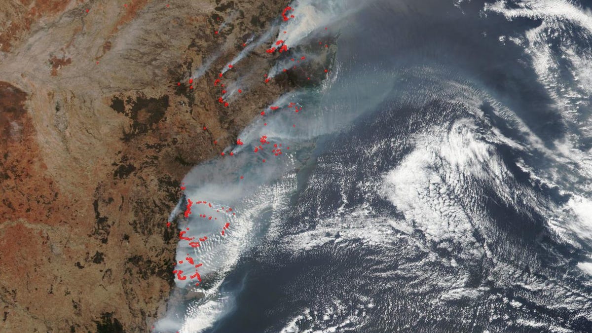
This Suomi NPP satellite image shows the massive amounts of smoke from actively burning fires, designated by the red spots.
New South Wales in Australia is under stress from a heatwave and ongoing bush fires that are eating up the landscape. The ground is choked with smoke that has reached into Sydney while the view from space reveals the extent of the damage.
The National Oceanic and Atmospheric Administration and NASA operate the Suomi NPP satellite. NASA released the satellite's look at New South Wales from Monday. It shows a massive blanket of smoke emanating from active fires marked by bright red spots.
"To date the size of the area burned is 1.5 times the size of the state of Connecticut (approximately 5.3 million acres of land)," NASA said. The New South Wales Rural Fire Service had logged 115 active fires as of Monday, with 59 of them still needing to be contained.
The fire threat looks like it may not let up for some time. "It has already been a challenging fire season and this is expected to continue," the Bushfire and Natural Hazard Cooperative Research Centre tweeted on Sunday while warning of increased danger as the fire season progresses.
What’s the #bushfireoutlook across Australia for summer 2019/20? It has already been a challenging fire season & this is expected to continue. All states & the ACT are warning of increased fire danger as the fire season progresses https://t.co/4qSfnKJyqQ @AFACnews @ABCemergency pic.twitter.com/zchj78qO4n
— BNHCRC (@bnhcrc) December 16, 2019
NASA's eyes in the sky will continue to monitor the fire situation in Australia. It's already bad, but it's likely to get worse.
Originally published Dec. 16, 4:33 p.m. PT